-
Call us now
+91-98126-52298
-
1st Floor, R.K. Tailor, Old Bus Stand,
Jind Road, Narnaund, Hisar
Digital Data Conversion/Digitization
We offer large-scale digital data conversion services, e.g., digitization and scanning of paper maps, scanned pictures and satellite images and make them ready in industry standard GIS formats. These also include Geo- coding, data capturing, raster to vector conversion and vice versa. Porting of linked vector maps and related data to client specified software is also provided.
Map Editing, Map Finishing, Map Publishing Services
Map editing includes map sheet layout and design; cleanup, topological and layer clean up, cartographic editing services, object data validation and corrections.
Some of the map finishing services include simple but critical GIS digital checks such as dangles, overshoots and undershoots, slivers, duplicate and incorrect data, wrong data attachment, verification of polygon centroid, edge match correction, verification of street directions, closed polygons etc.
Other services include updation of maps through recent satellite sensor data; data inputs, scanning using A0 scanners and generation of high quality products using high resolution colour plotters.
Toposheet Digitization
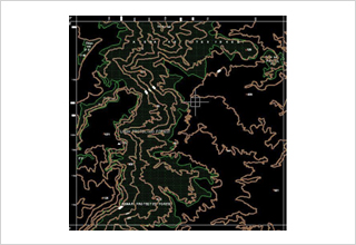 Derived maps prepared from the SOI toposheets to the specific projects where some thematic information is need to be transferred to get more realistic results on the project.
Well Log Data Digitization
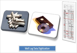 Well log data digitization includes Scanning of logs at appropriate resolution in Tiff format, Registration and Calibration in Software, Gridding (Verifying the depth lines with Grid), Digitization of all Curves as per client’s instructions, Capture Well Site Information for each log, Editing and Quality Control of all curves, Quality Implementation, Quality Assurance. Well log data delivered in LAS file as Output.
Cadastral Mapping
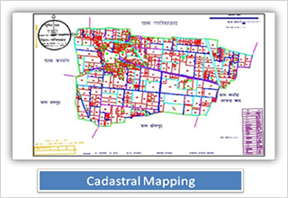 The digitization of village (Cadastral) maps to preserve the data available in the documents, facilitate its easy storage, retrieval and greater access to the public and functionaries of the Department and to create database of the revenue maps/ musavis in digitized form and will get linked up with the existing database of Land Records Management System.
Landbase Creation Using Satellite Data
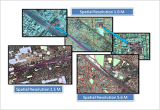 We provide Spatial and Non-spatial information using satellite image on various resolution depending on the need of the projects. Scope includes the image interpretation and vectorization expertise to provide the project specific deliverables.
Landbase Updation Using Satellite Data
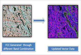 Landbase created thru different sources finally updated by using recent satellite images to complete the objective of the project.
Landuse Classification
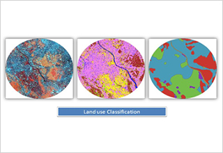 Landuse map prepared to study the landuse pattern of the desired area to achieve the specific goal of the project.